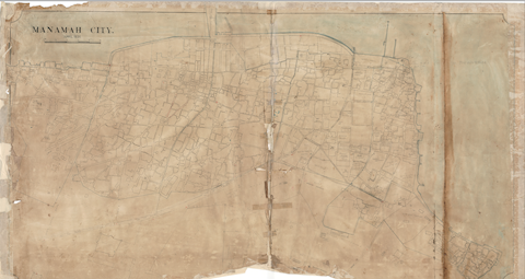
This name, steeped in historical significance, reflects the early stages of formalised land administration and underscores the Bureau's enduring legacy. The department's establishment aimed to systematically organize and register all properties within the Kingdom of Bahrain, thereby safeguarding both public rights of the state and the private rights of its citizens. Its initial task was to conduct a comprehensive survey of all properties across the country, culminating in the ‘General Survey Register’. Completed in 1926, this register became the official and recognised reference point for documenting public and private land ownership.
Reflecting the evolving property sector, the Bureau's name was amended to the "Land Registration Department" in 1967. A significant organisational shift occurred in 2003 with the amalgamation of the Survey Department, established in 1978 under the Ministry of Housing. This merger, formalised by Law Decree No. (43) of 2003, resulted in the Bureau's current name: the 'Survey and Land Registration Bureau'.
1920 - 1929

1924
Establishment of the Tapu Department (currently known as the Survey and Land Registration Bureau).
1926
Completion of the first comprehensive survey in the Kingdom of Bahrain, documented in the "General Survey Register"
1960 - 1969
1970 - 1979
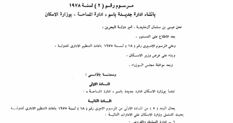
1978
Creation of the Survey Department under the Ministry of Housing, according to Decree No. (2) of 1978 (11/3/1978).

1978
Establishment of the Marine Survey Office within the Survey Directorate
1980 - 1989

1983
Conversion of maps at a scale of 1:1000 to digital format using aerial photography.
2000 - 2009
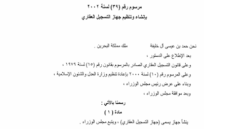
2002
Organisation of the Land Registration Bureau under Royal Decree No. (39) of 2002 (14/10/2002).
2003
Reorganisation of the Bureau by merging the Survey Department and changing the name to the "Survey and Land Registration Bureau" in accordance with Legislative Decree No. (43) of 2003 (19/4/2003).
2010 - 2019
2014
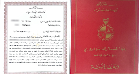
printing the title deed electroniclally

2015
Inaugurating the permeant exhibition of the Survey and Land Registration Bureau
2020 - 2029

2021
Launch of the new one page title deed
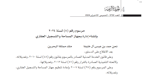
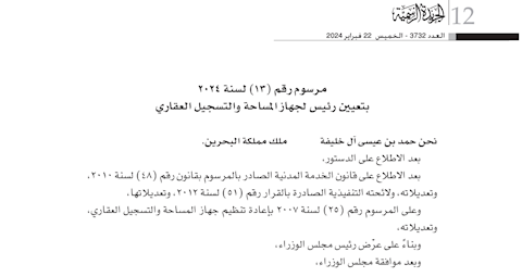
2024
Decree No. (8) of 2024 on the Establishment of a Department within the Survey and Land Registration Bureau

2024
Launching the change detection and building violation system using artificial intelligence

2024
Launching the "Book Your Appointment" service through the national appointment system and the "Mawaeed" app.

2025
Launching the "Property Check" service to instantly verify the existence of legal restrictions on a property.